



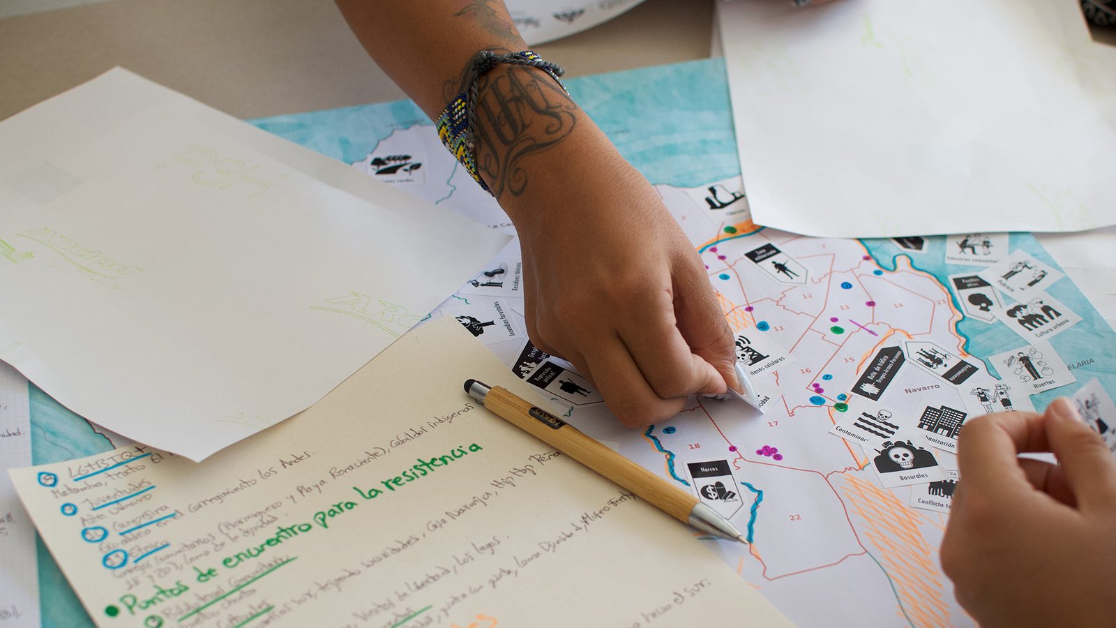
As a result of the collaborative mapping project ‘Cartografía para la re-existencia’ (Cartography for the re-existence) of the city of Cali, a new counter-map reveals the territorial reconfiguration five years after the social outburst.
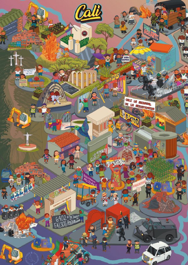
Convinced of the power of storytelling and collective construction through maps, a new purpose brought us together in the city of Cali: to develop a collaborative cartography to interpret the current realities and disputes coexisting within the territory. In 2021, Cali experienced a process of mass mobilisation in protest against the country’s social, economic and political inequalities, which came to be known as the ‘social outburst’. Since then, the city has been recognised as the capital of resistance, where the historical struggles of the diverse peoples and communities inhabiting south-western Colombia converge. Against this backdrop, memories, inequalities and organisational processes converge, continuing to challenge the present and imagine other possible ways of life.
Cali, the city of the seven rivers, consists of 70% rural territory, organised into 15 administrative districts, some of which form part of the Farallones de Cali National Natural Park. This territory boasts a great diversity of flora and fauna, including some 561 species of birds – almost 30% of the country’s total birdlife. This is one of the key features that this new map sought to highlight. Paradoxically, the rural area has been one of the hardest hit in recent decades. It’s facing environmental issues such as water pollution caused by gold mining and high concentrations of mercury and lead, particularly in the districts of Pichindé, Felidia and Los Andes. Meanwhile, the districts of Golondrinas, Montebello and La Buitrera are being affected by mining for construction materials and coal, as well as the extraction of dragged materials such as sand and stone in Pance.
Added to this reality is the rapid process of gentrification currently taking place in rural Cali, driven by the expansion of high-cost property developments. This phenomenon has led to the gradual displacement of rural communities, rising land prices, taxes and utility bills, as well as to the increasing pressure on community water systems and other common goods that sustain life in the area. In this context, land—its tenure, use and significance—continues to be a source of contention, not only in rural Cali but also in the city centre, where different actors are pitted against one another over opposing models of the city, development and ways of inhabiting the territory. Evidence of this can be seen in mega-projects such as Ciudad Paraíso and Plan Jarillón, which have led to the eviction of communities through the excessive use of the public forces and to relocations that continue to widen the vast gaps of inequality.
We, as women, continue
to create spaces
for dialogue, care and
advocacy through a variety
of organisational processes.
This new map has also highlighted the intensification of the conflict and the rise in hostile actions by various armed groups in the region. This is now affecting Cali as the economic, political and social hub of south-western Colombia, and as a strategic territory for drug and arms trafficking routes. The areas identified as being most affected by conflict are in the east of Cali and on its hillsides, where phenomena such as extortion, murders, ‘invisible borders’, small-scale drug trafficking, recruitment, the presence of gangs and armed groups, and human trafficking converge. Against this backdrop, Cali has also been the scene of a worrying escalation of violence, reflected in explosions and attacks targeting the public forces, using car bombs, motorbikes laden with explosives and gas cylinders launched from makeshift ramps – incidents in which the civilian population has been among the main victims.
We are collaboratively building a map that seeks to create a narrative of the territory, enabling an understanding of what is happening in its many dimensions: in the places themselves, in those who inhabit them, and in those who continue, day by day, to build a city for everyone. In this exercise, the processes of re-existence driven by social movements and organisations are fundamental to understanding territorial disputes and the struggles that seek to counteract and transform the deep-rooted inequalities and injustices affecting the city.
In rural areas, organisational efforts have focused on defending rivers, nature reserves and the species that inhabit them, as well as on promoting responsible land use and fair land tenure. At the same time, cultural expressions such as dance, theatre, hip-hop, painting, film and mural art are gaining momentum in rural areas, on the hillsides and in the eastern part of Cali as tools for peace-building, resistance and social transformation.
We women, through a wide range of organisational initiatives, continue to create spaces for dialogue, care and advocacy, demonstrating that where the map reveals areas of conflict, multiple forms of organisation and re-existence are also flourishing, sustaining life in the region.